PMP and PMF for Design by HEC-MetVue and HEC-HMS (1 of 2)
Probable maximum precipitation (PMP) is theoretically the greatest precipitation for a given duration that is physically possible over a given size storm area at a particular geographic location. Probable maximum storm (PMS), often developed from PMP by accounting for rainfall distribution using procedures and data in NOAA HMR 52 and HMR51, is widely used by engineers for the estimation of Probably Maximum Flood (PMF) to plan and design high-risk infrastructures such as reservoirs and dams. HEC of USACE developed a set of H&H modeling tools to develop PMS and PMF to support such tasks, including HEC-MetVue and HEC-HMS.
As shown in Figure 1A, HMR51 and HMR52 are applicable to United States East of the 105th Meridian and for other areas of the country, other PMP documents are available from NOAA. It is worth noting that some local or state governments may have conducted their own PMP studies in recent years and these new studies usually take precedence over the old NOAA studies, for example, the Regional Probable Maximum Precipitation Study For Oklahoma, Arkansas, Louisiana, and Mississippi and its tool.
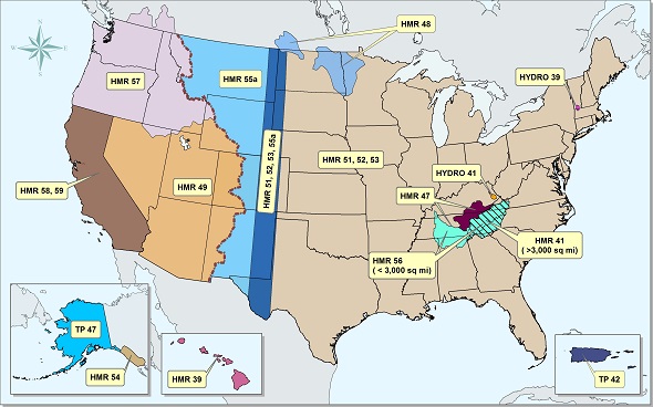
As shown in Figure 1B, HEC-MetVue with its built-in HMR52 plugin will estimate an initial PMS by maximizing the precipitation depth over the given watershed area. The initial PMS with its key parameters (storm area, storm center location X and Y, orientation angles, Depth-Area-Duration, 1:6 hour ratio, peak intensity period) can then be passed on to HEC-HMS HMR52 storm method for further optimization by maximizing peak discharges volume, or stage depending on the project needs.

This post will focus on how to employ HEC-MetVue and its HMR52 plugin to generate an initial PMS. The second post will deal with using HEC-HMS to optimize the initial PMS created by HEC-MetVue.
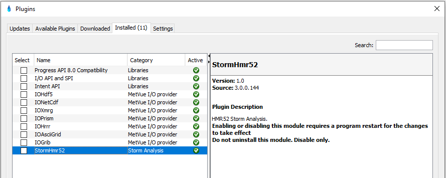
First of all, after opening HEC-MetVue, go to Tools –> Plugins to ensure HMR52 plugin “StormHmr52” is installed and activated as shown in Figure 2.
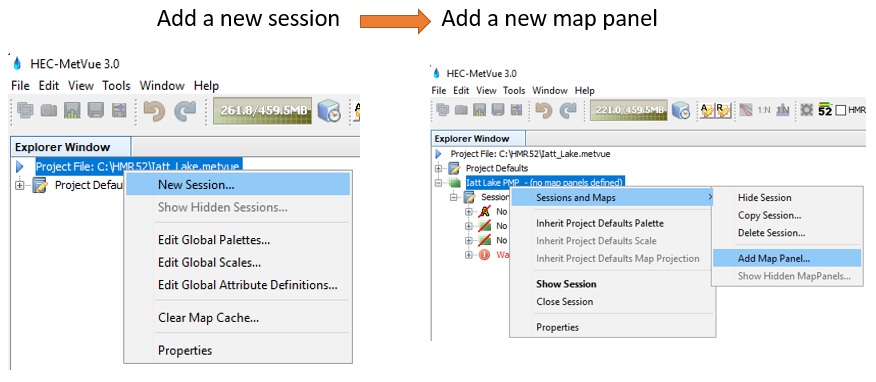
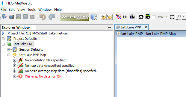
The basic operation unit in HEC-MetVue is a map panel and that’s why as a minimum, a HEC-MetVue project file must have at least one session and this session must have at least one map panel. After creating a new project file in HEC-MetVue , right click the project file at the top of the Explorer Window to create a new session and then right click this new session to generate a new map panel (Figure 3). In Figure 4, a new map panel “Iatt Lake PMP Map” is created under the session “Iatt Lake PMP“. “Iatt Lake PMP Map” is a blank map panel for now since it is just created.
Open HMR52 plugin, load a basin boundary shapefile (watershed), and choose appropriate settings/parameters by following steps in Figure 5, 6, 7, and 8. Since the basic operation unit in HEC-MetVue is a map panel, for any operation including opening HMR52 plugin illustrated here, a map panel must be first activated or selected; otherwise, the tool bar at the top of HEC-MetVue window will be greyed out.
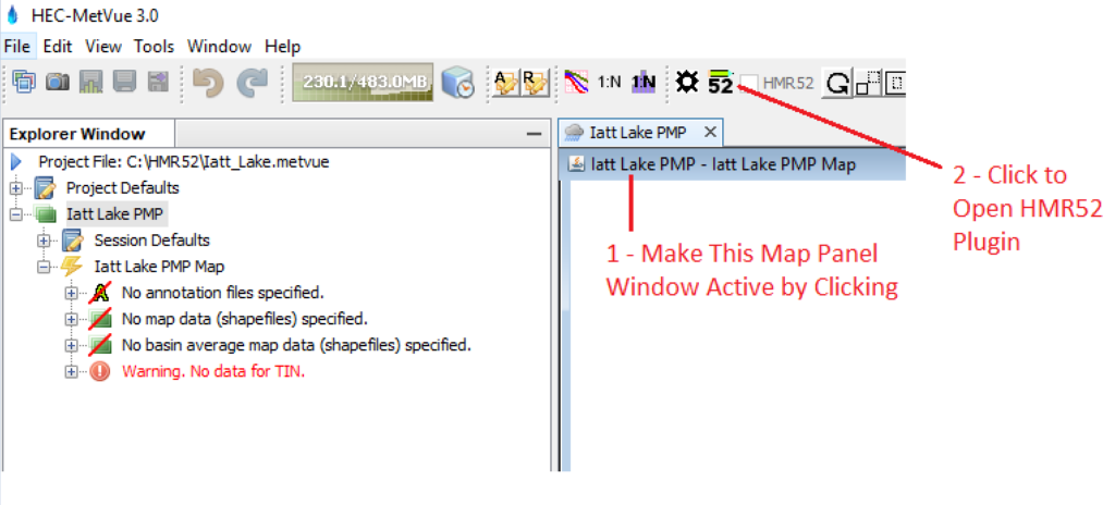
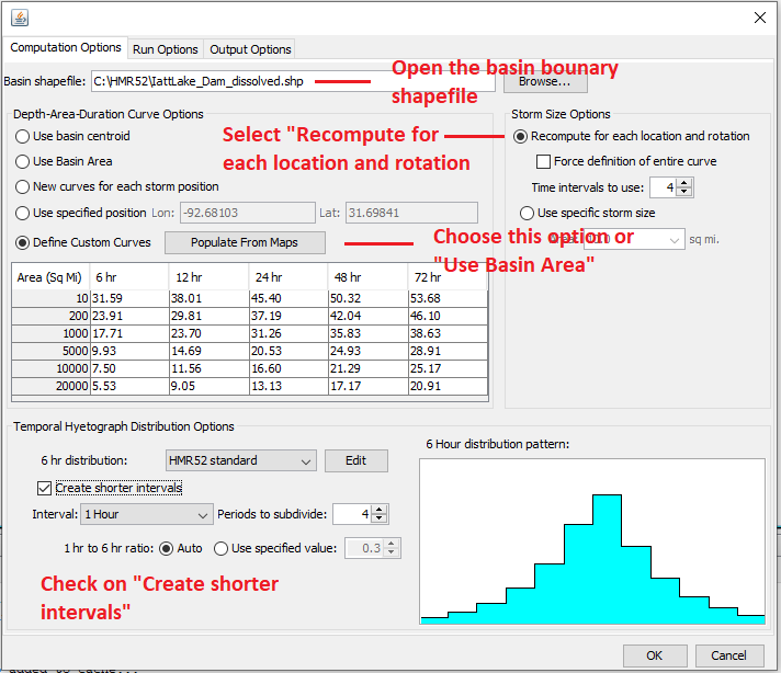
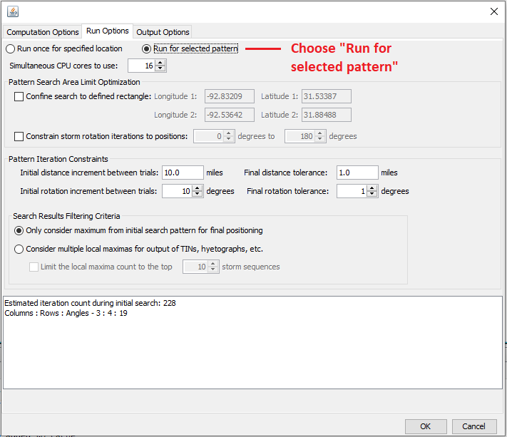
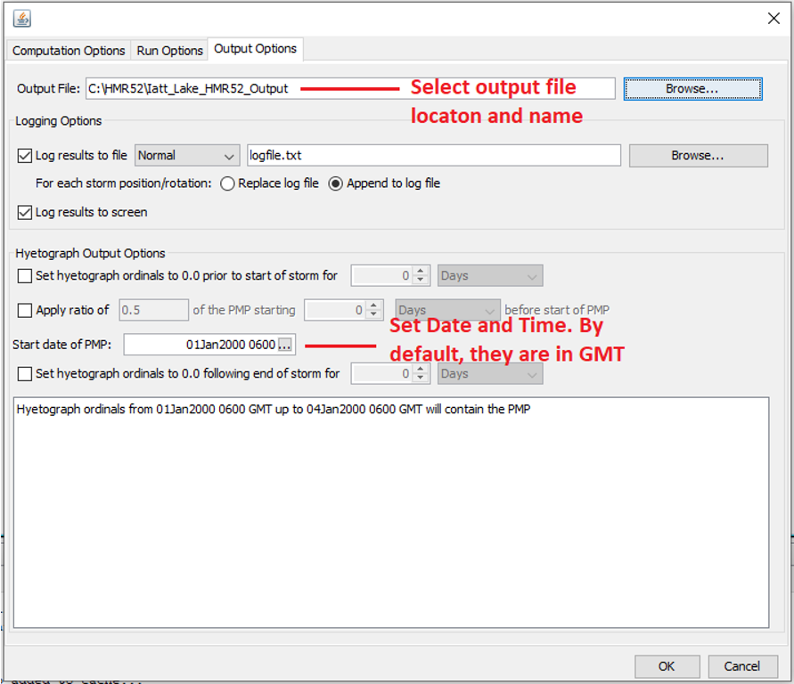
After working through the 3 tabs in Figure 6, 7, and 8, click the OK button and select “Yes” when prompted to add the shapefile to the map panel. The resulted PMS ellipse is shown in the map as in Figure 9. To verify if the PMS ellipse is located at the right place, a google map can be turned on as background image (Figure 10).
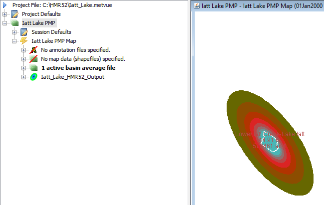

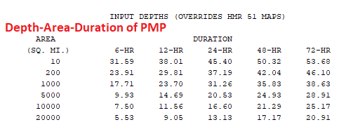
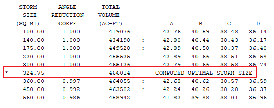
The PMS ellipse above is created aiming at maximizing the precipitation depth over a basin. A PMS with the maximum precipitation depth does not necessarily generate a PMF since the runoff of a basin is not in a simple linear relationship with the precipitation. Nevertheless, the PMS from HEC-MetVue is a good starting point of precipitation for PMF calculation and its parameters can be entered into HEC-HMS for further optimization. The PMS parameters which show up at the bottom of HEC-MetVue window – output message (Figure 11, 12, and 13) can be saved as inputs for HEC-HMS HMR52 storm method, including storm center location, 1:6 hour ratio, optimal storm angle (preferred orientation), angle used for computation, Depth-Area-Duration, and optimal storm size in square mile.

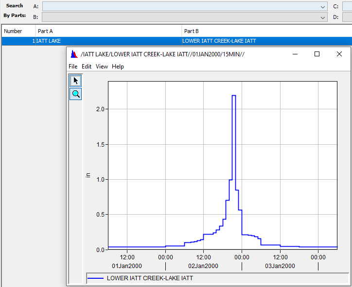
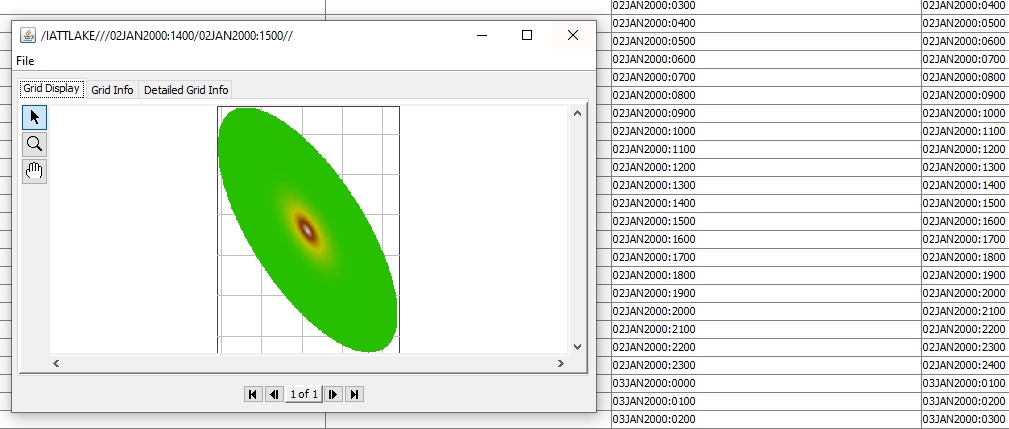
The PMS created in HEC-MetVue can be saved as a time series (incremental precipitation in inch) in a version 6 DSS file (Figure 14 and 15).

The PMS can also be saved as time series grid dataset in a version 6 DSS file or ESRI Grid files (*.asc) as shown in Figure 16 and 17.

3 COMMENTS