Download DEM from National Map Viewer by USGS
USGS DEM (Digital elevation models) are arrays of regularly spaced elevation values referenced horizontally either to a Universal Transverse Mercator (UTM for 1-meter DEM) projection or to a geographic coordinate system (EPSG 4269 for 1/3 and 1/9 arc-second DEM, in units of decimal degrees, horizontally referenced to the North American Datum of 1983 or NAD83). The DEM products include 2, 1, 1/3, and 1/9 arc-second layers, as well as 5-meter DEMs in Alaska and 1-meter DEMs in the conterminous U.S. For hydrology spatial analysis purpose, higher resolution DEMs shall be utilized if available. Since 1/3 arc-second DEM has a resolution of 10 meters and 1/9 arc-second DEM has a resolution of 3 meters, so if 1/3 arc-second, 1/9 arc-second, and 1-meter DEMs are all available for your project area, the order from higher to lower resolution is 1-meter DEM, 1/9 arc-second DEM, and 1/3 arc-second DEM.
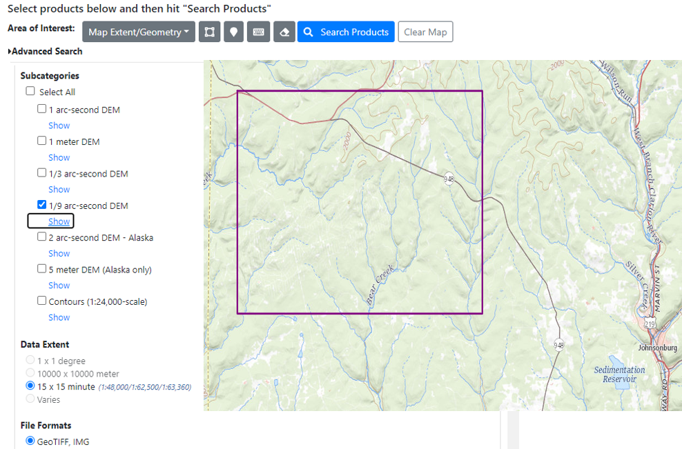
USGS DEM can be downloaded from National Map Viewer Website and this post is a step by step instruction on how to download a DEM for your project area. Th example project site is Bear Creek watershed, located at about 9 miles west of Johnsonburg, PA (Figure 1).
- Go to National Map Viewer Website and zoom in to the project area. Draw bounding box to define your Area of Interest (Figure 1). Check on Elevation Products (3DEP) on the left side for Data type and you can click Show or Hide under each DEM type (1/3 arc-second DEM, 1/9 arc-second DEM, or 1-meter DEM). Select the DEM type with the highest resolution available to your project area and check File Formats as “GeoTIFF, IMG” which is normal for DEMs. For this demo, 1/9 arc-second DEM is selected since 1-meter DEM is not available for the project area.
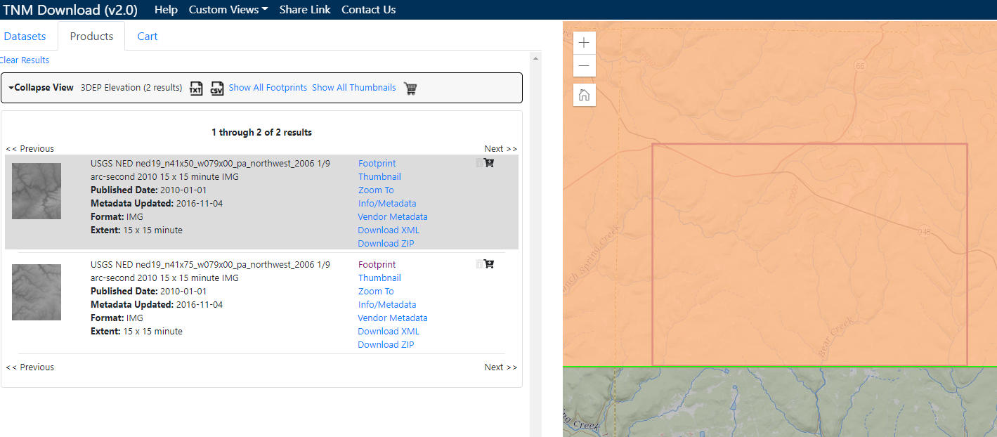
- Click Search Products on the top menu and the available DEM files of the selected DEM type will be shown on the next page (Figure 2). Click Footprint (on/off) of each DEM file to show their coverage areas. If you are satisfied with one or multiple DEM files, click Download ZIP for downloading. In this demo (Figure 2), two DEMs are found, by showing the footprints on and off, it is determined that the second DEM is only bordering the south boundary of the area of interest, and so only the first DEM (top one on the list) was downloaded.
- For this demo, the downloaded 1/9 arc-second DEM is in reference to CRS EPSG 4269 in units of decimal degrees, horizontally referenced to the North American Datum of 1983 or NAD83. In order to perform hydrology spatial analysis, normally you will need to re-project it to a projected CRS like UTM (for continental USA, UTM NAD83 Zone 10N to 19N from west coast to east coast), or State Plane Coordinate System.
- Another better GIS practice is to clip the re-projected DEM to an area just greater than the supposed watershed to reduce file size for easy manipulation.
- Usually USGS DEM elevations are in unit of meter and you may need to covert the elevation from meter to foot for projects and applications in USA using GIS raster calculator (foot=meter*3.28084).
Leave a Reply