Basin Development Factor (BDF) and Its Application in Urban Hydrology
Urbanization has some substantial impacts on a watershed hydrology including increased surface runoff flow rate and volume, quicker to peak, decreased infiltration and evapotranspiration. To account for these effects in an urban area hydrology modeling, different methodologies have been studied and proposed. Basin Development Factor, or BDF, is an index of urbanization which provides a measure of the efficiency or development of the drainage system. BDF was first proposed in a 1983 USGS study titled of Flood Characteristics of Urban Watersheds in the United States and since then it has gained some popularity in H&H modeling due to its simplicity and reproducibility.
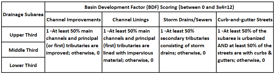
BDF was originally proposed as an index that could be easily determined from drainage maps and field inspections of a drainage basin. To achieve this goal, the 1983 USGS study suggested that a basin be first divided into three subareas of about equal sizes (Figure 1) and within each subarea four aspects of the drainage system be evaluated and scored as explained in Table 1. The final BDF value is the sum of all the scores which will range from 0 (undeveloped) to 12 (fully developed or urbanized).
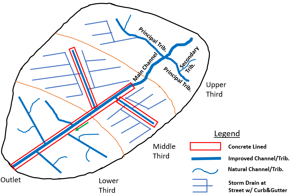
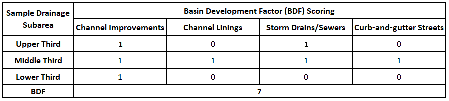
For the example watershed of Figure 1, BDF can be easily estimated to be 7 as illustrated in Table 2. However, this watershed is heavily idealized and simplified, and for a real world watershed the BDF scoring process is often arbitrary and subjective. Another BDF calculation example can be found here from FDOT Drainage Design Guide.
BDF estimation has been improved and revised over the years since its introduction, for example, a new BDF scoring methodology was developed by USGS and Harris County Flood Control District in 2011 which gives a intermediate score of 0.5 for some categories to better represent the Houston area drainage characteristics (USGS Report 2011-5104 Appendix 1).
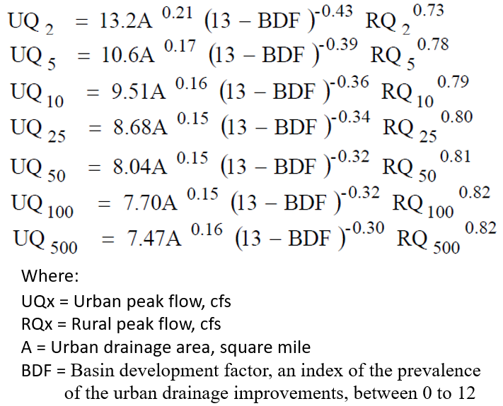
BDF can be used to estimate peak flows for urban basins by adjusting peak discharges from USGS regression equations most of which were developed for rural areas. The 1983 USGS study titled of Flood Characteristics of Urban Watersheds in the United States proposed 3 sets of equations to account for urbanization impacts using BDF, Drainage Area, Impervious Surface, Storage, Channel Slope, Lag Time, and Rainfall. The simplest one, which only employs two parameters – Drainage Area and BDF, is shown in Figure 2.
BDF has also been successfully adopted to estimate other hydrologic parameters such as Time of Concentration (TOC) and storage coefficient R for Clark Unit Hydrograph Method. In the USGS Report 2011-5104 a set of regression equations were developed to estimate TOC and in 2012 Harris County of Flood Control District presented a method to estimate R (Figure 3).
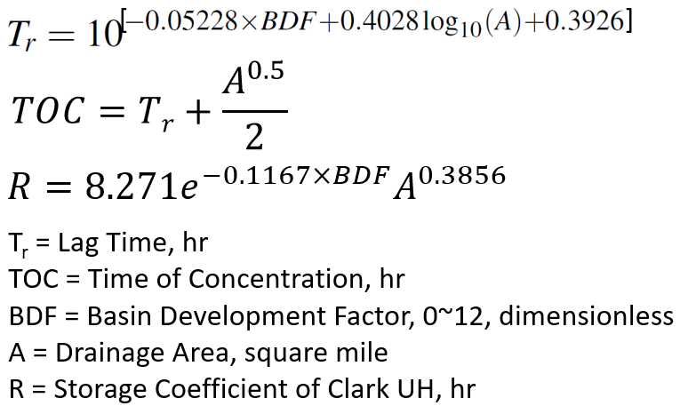
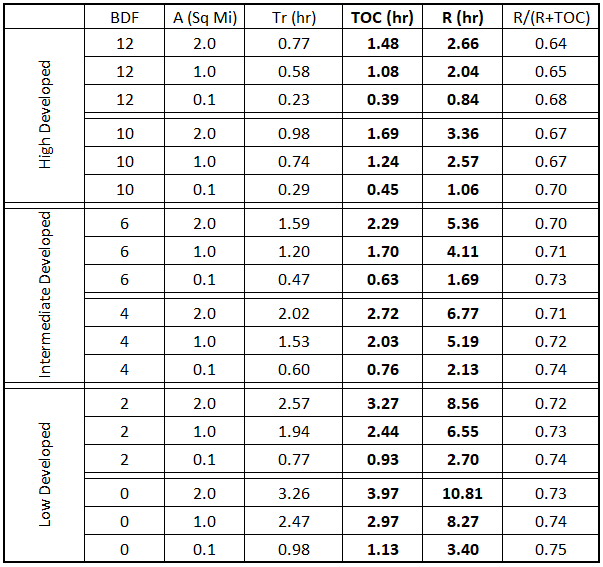
TOC and R of 3 watersheds with different drainage areas (2.0, 1.0, and 0.1 square mile) and different BDF are calculated using equations in Figure 3 and the results are shown in Table 3. It seems that TOC and R are highly sensitive to BDF, however, the ratio of R/(R+TOC) is pretty consistent: about 0.73 for low developed BDF, 0.71 for intermediate developed BDF, and 0.67 for high developed BDF.
It is obvious that the equations in Figure 3 only use BDF and Drainage Area A to calculate TOC and R, and neither of them takes consideration of channel slope or detention/storage attenuation effect. For this reason, the equations in Figure 3 need to be further adjusted by considering effects of channel and overland slopes as well as detention.
Leave a Reply