HEC-HMS Meteorologic Model – Gridded Precipitation
Historical hourly or daily precipitation data in gridded format can be imported into a HEC DSS file used by HEC-HMS as time series gridded dataset or gridsets. The commonly available precipitation data in gridded format includes MRMS, Stage IV, or PRISM data. Refer to this post about how HEC DSS handles time series gridded dataset and how to import such gridded dataset into a DSS file.
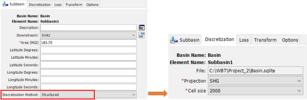
To apply the gridded precipitation method in a HEC-HMS model, the subbasins must be discretized as shown in Figure 1A.
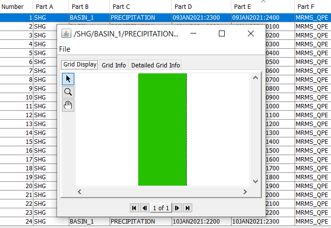
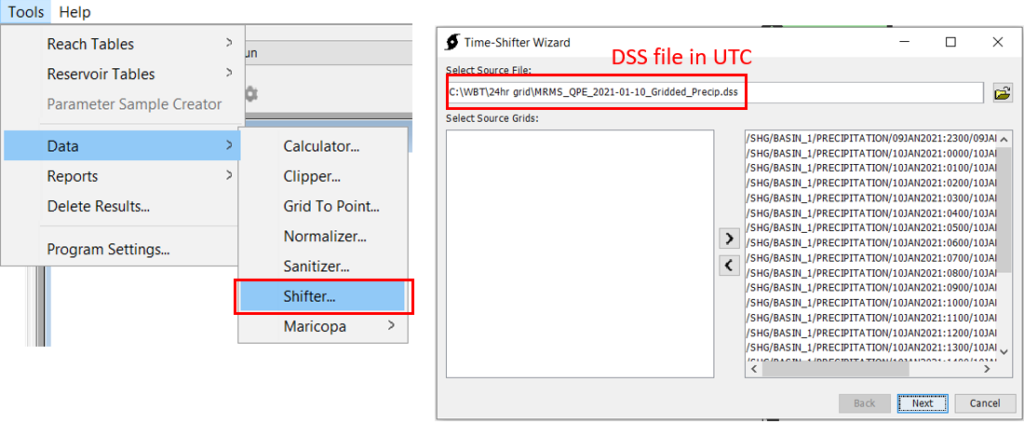
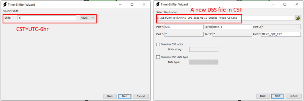
In this example, MRMS QPE hourly data for Jan 10, 2021 was downloaded from IA State University Mesonet Website and imported to a DSS file (Figure 1B) after being clipped by the basin boundary shapefile. A better practice here is to use a buffered basin boundary shapefile as “clipper” to ensure enough precipitation coverage. Since the time zone of the downloaded MRMS QPE data is in reference to UTC+00:00 and the example project area is in Central Standard Time zone (CST), the DSS file is further converted to a new DSS file in CST by using the built-in HEC-HMS Tool of Time Shifter (Figure 2 and Figure 3). Time Shifter uses -hours to shift to time zones west of UTC+00:00 and +hours for time zones east of UTC+00:00.
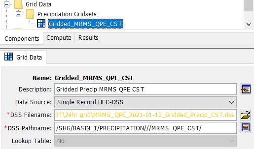
The new DSS file with records in reference to CST is illustrated in Figure 4. Next introduce the new DSS file into HEC-HMS as Grid Data – Precipitation Gridsets (Figure 5). The DSS pathname can use any single record’s pathname in the gridsets, or simply leave Part D and Part E as blank as shown in Figure 5.

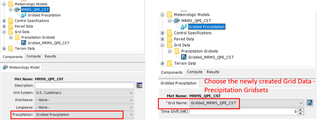
Create a new meteorologic model with its precipitation being set as “Gridded Precipitation” and choose the grid name as the one created early (Figure 6). This meteorologic model can be used to simulate the historical storm event happening from 17:00 of Jan 09, 2021 to 17:00 of Jan 10, 2021 CST (or 23:00 of Jan 09, 2021 to 23:00 of Jan 10, 2021 UTC).
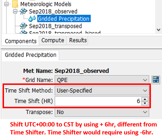
It should be noted that the starting from HEC-HMS V4.10, time shifting of gridded precipitation can be also done when defining a meteorology model as gridded precipitation with Time Shift Method being User-Specified (Figure 7). The positive or negative sign of the time shift hours entered here is the opposite of what Time Shifter would require.
HEC-HMS has the following suggestion on handling time zone misalignment, which seems to suggest that using Time Shifter to make the conversion first is the preferred way (Figure 8).

Leave a Reply