Burn a Stream or Raise a Wall in QGIS and WhiteboxTools
Often it is necessary to re-condition a DEM by burning streams or building walls to force a watershed to be delineated with known streams or boundaries (example: NHD streams or WBD HUC boundaries). QGIS provides a couple of convenient tools for burning a stream or raising a wall inlcuding r.carve, FillBurn, RaiseWalls, and BurnStreamsAtRoads.
r.carve
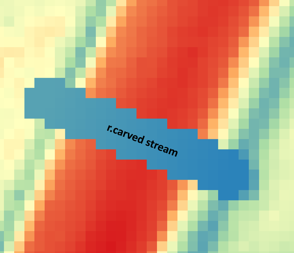
r.carve is a tool coming with the Grass GIS plugin. A shapefile (linear, denoting stream centerlines) is needed to burn streams into the DEM (Figure 1). The resulted DEM is included in Figure 2.
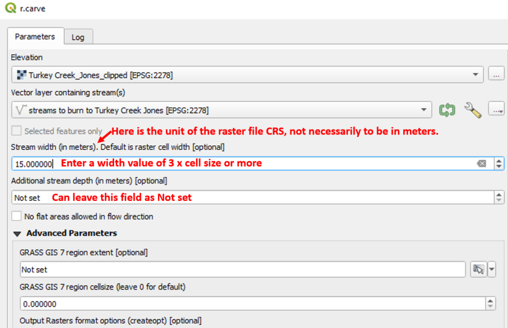
To improve the result, try to use different stream width and additional stream depth values, as well as toggle on or off the option of “No flat area allowed in flow direction”.
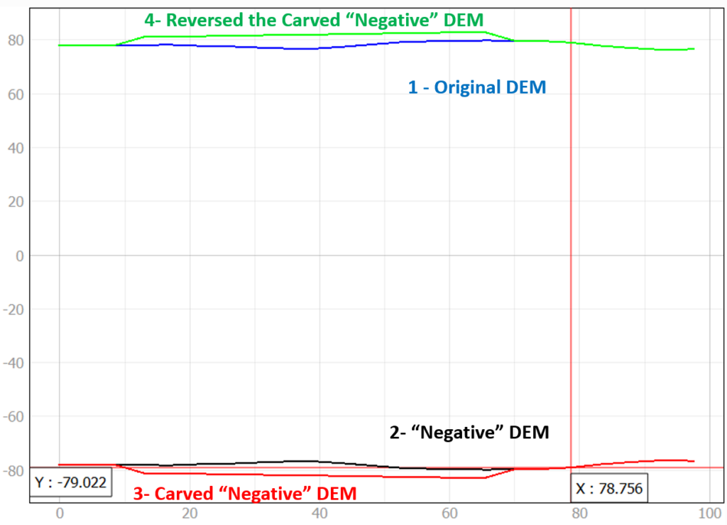
r.carve can also be used to build a wall or a dam by following the steps below:
- Use Raster Calculator to create a new “negative” DEM by the equation of original DEM@1 * -1
- Use r.carve to cut a stream in the new “negative” DEM
- Use Raster Calculator to reverse the new “negative” DEM to positive by the equation of carved “negative” DEM@1 * -1
FillBurn
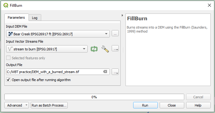
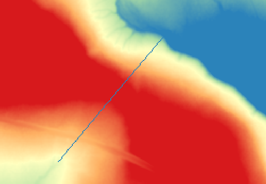
To use this tool, the whitebox tools (WBT) plugin needs to be installed first (Figure 3). Similar to r.carve, a stream alignment needs to be provided as a linear shapefile. The resulted DEM is shown in Figure 4.
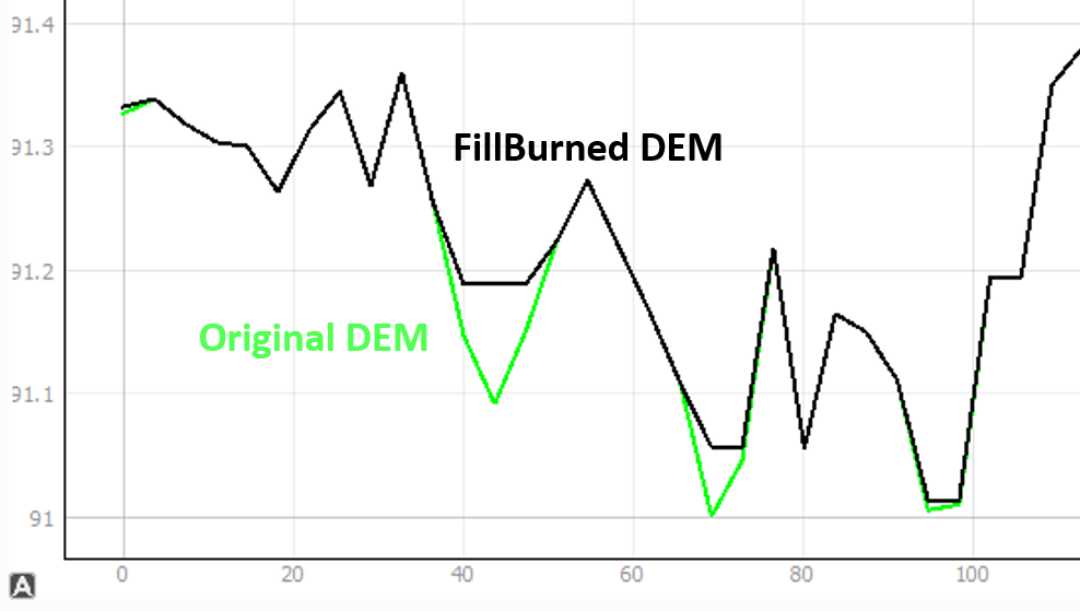
It appears, as its names suggest, when a stream is burned into the DEM by FillBurn, the DEM will also be filled (Figure 5). Be mindful of this feature of FillBurn.
RaiseWalls
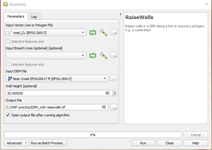
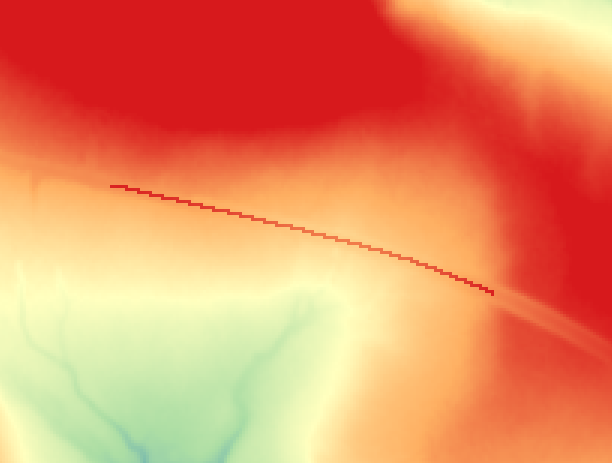
To use this tool, the whitebox tools (WBT) plugin needs to be installed first. RaiseWalls burns a wall with a specified height above an existing DEM ground (Figure 6). The wall alignment needs to be provided as a linear vector shapefile. An optional breach line may be needed so the area surrounded by the newly erected walls will not become depressed. The re-conditioned DEM with the new wall is shown in Figure 7.
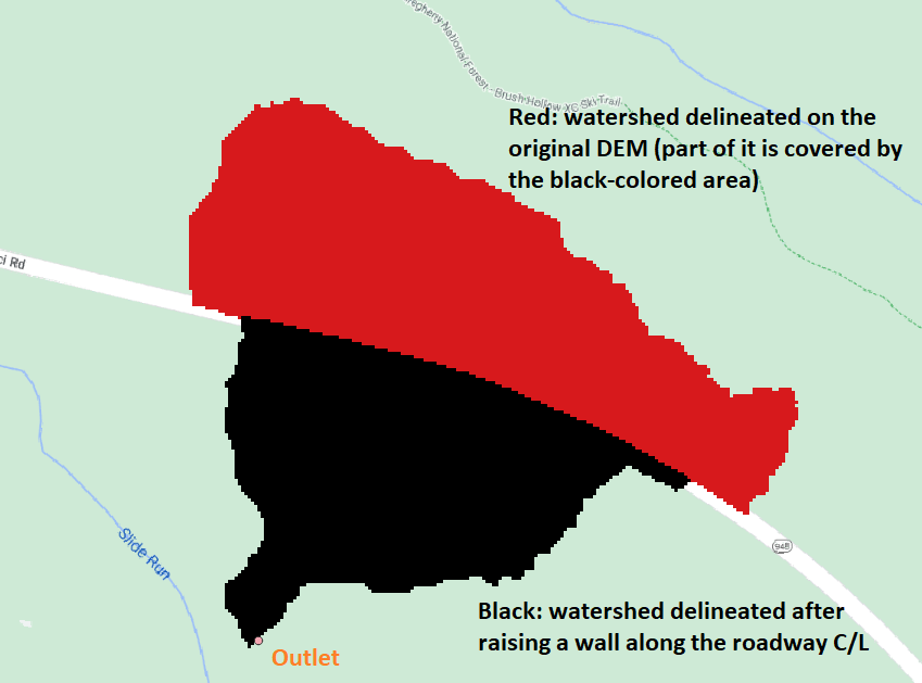
The watersheds delineated after and before the wall is burned are shown in Figure 8. It is obvious the new wall blocks the flow coming from the upstream side, which results in a much smaller watershed.
BurnStreamsAtRoads
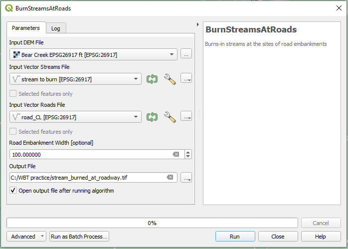
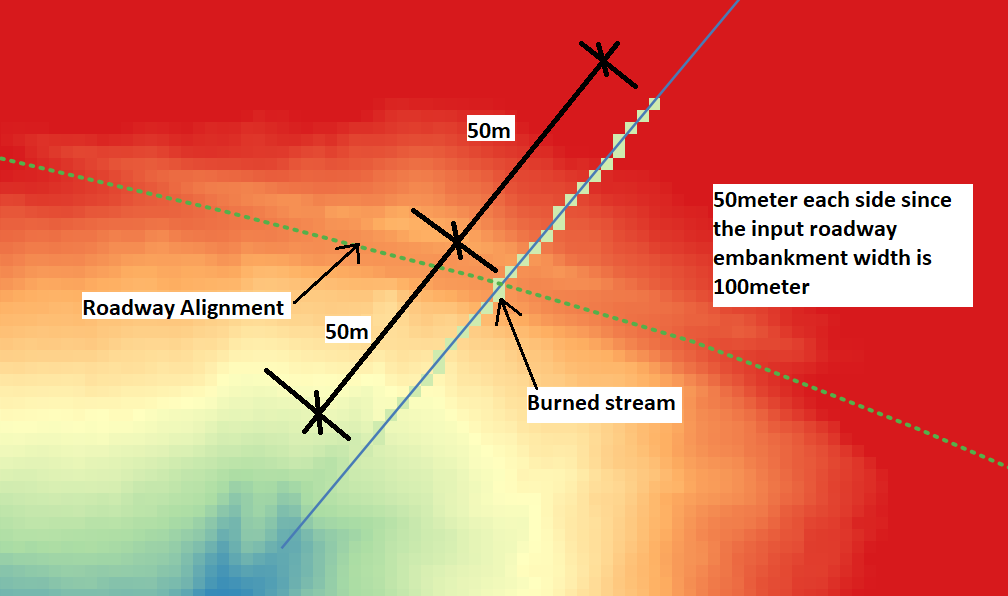
To use this tool, the whitebox tools (WBT) plugin needs to be installed first (Figure 9). This tool is convenient to burn a stream crossing an roadway embankment if the DEM or LiDAR does not pick up the crossing where there is a culvert or a bridge. Two vector shapefiles are required: one for stream alignment and the other for roadway. The stream alignment should connect to the existing stream on either side of the roadway. The burned stream is along the stream alignment and its length is determined by the Road Embankment Width value (half of it on either side of the roadway, Figure 10). It appears that the value of Road Embankment Width must be provided, and otherwise, the output DEM is the same as the input DEM.
Leave a Reply