Terrain Modification in RAS Mapper (3 of 3)
RAS Mapper of HEC-RAS 6 has a set of terrain modification tools to modify original terrain. This post is the third of the 3 post series for terrain modification using the simple shape terrain modification method. Post 1 of 3 focuses on line terrain modification and Post 2 of 3 is for polygon terrain modification.
It is a good practice to create a virtual clone terrain first and work with terrain modifications on this virtual terrain to keep original terrain untouched. Refer to Post 1 of 3 for virtual clone terrain creation.
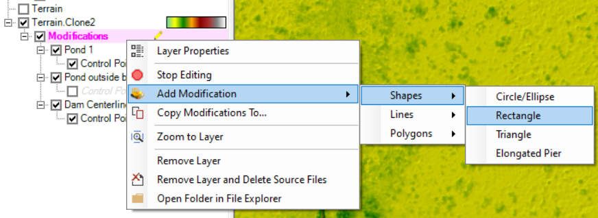
The simple shape terrain modification is to apply “simple” shapes to modify original terrain using single elevation, and the “simple” shapes include Circle/Ellipse, Rectangle/Square, Triangle, and Elongated Pier. Each shape will only contain one single elevation value and the option of Elevation Control Points is not available. Let’s start with adding a square to explore the simple shape terrain modification function.
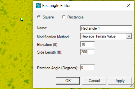
- Right click the Modifications layer to select Add Modification —> Shapes —>Rectangle (Figure 1) to add a square to denote a fill. Click at the approximate fill location to add the square and enter data in the Rectangle Editor on Figure 2.
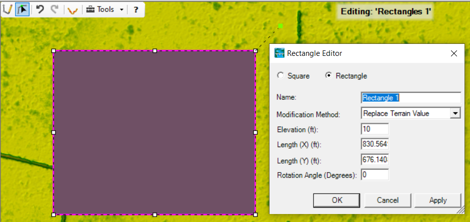
2. After entering the initial parameters for the square, switch to Edit Feature of the geometry editing tool bar, click the newly added square to select it, and hold down the mouse to move it to another location if needed; or its parameters can be further edited (Figure 3).
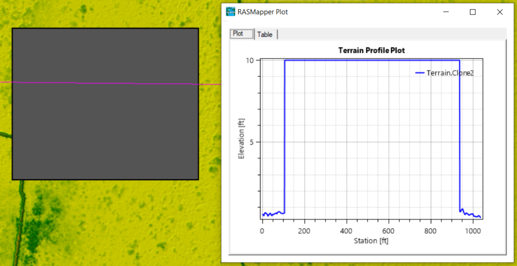
- The new square shaped fill can be reviewed by drawing a profile line across it (Figure 4).
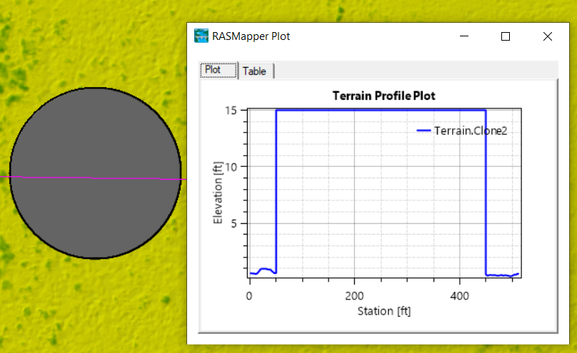
- A circular shaped fill area can be added in a similar way (Figure 5).
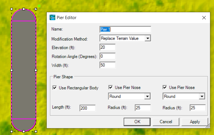
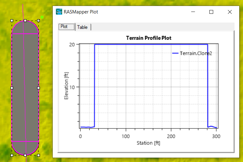
5. A bridge pier is another available option for this type of terrain modification method (Figure 6 and Figure 7)
6. At the end of editing, make sure to click Stop Editing to save the changes.
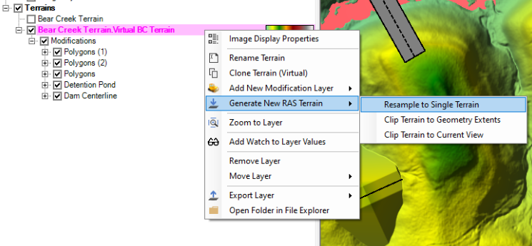
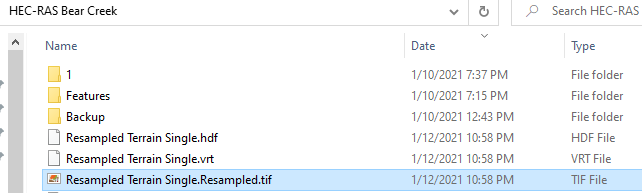
Terrain modifications are implemented as vector additions to the original terrain layer to avoid creating unnecessary extra terrain raster files, however, users have the option to output the modified terrain (original terrain plus modifications) into single terrain by right clicking Terrain —> Generate New RAS Terrain —> Resample to Single Terrain (Figure 8). Three files are to be created by resampling (*.hdf, *.vrt, and *.tif in Figure 9).
Leave a Reply