Import NLCD Impervious Raster File as HEC-RAS Land Cover Layer for Percent Impervious Values
In HEC-RAS 2D Rain-on-Grid (ROG) modeling, three layers are needed to model the infiltration loss and the procedures to create the three layers have been discussed before.
- Land Cover Layer – normally is created from NLCD Land Cover raster files or C-CAP raster files. Two values are provided by a land cover layer: Manning’s n and Percent Impervious. Infiltration does not happen on an impervious surface.
- Soils Layer – normally is created from SSURGO or gSSURGO dataset to define soil textures or hydrologic soil groups.
- Infiltration Layer – can be created from Land Cover Layer and Soils Layer by intersecting them or can be created just by the Soils Layer, or from a new shapefile.
As discussed in this post, it is a common practice to create one land cover layer for a HEC-RAS 2D ROG project and this single land cover layer provides Manning’s n values for friction calculation and percent impervious values for infiltration calculation (Figure 1).
However, how to assign a percent impervious value to each land cover type is not well studied and documented and therefore it usually depends on a modeler’s experience and model calibration. To make the above process rely less on personal judgment call, it may be preferable to let HEC-RAS read percent impervious values directly from NLCD impervious raster files. A second land cover layer needs to be created using NLCD impervious raster file and it will only supply percent impervious values while the first land cover layer is to only provide manning’s n values.
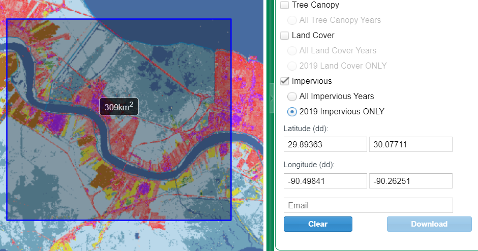
NLCD impervious raster files can be downloaded from https://www.mrlc.gov/viewer/ (Figure 2). The downloaded impervious raster file (EPSG 5070 – Albers Equal Area Conic Projection NAD83) has a resolution of 30m x 30m and its pixel values are Percent Impervious (0 to 100).
In RAS Mapper, a second land cover layer is created by importing the impervious raster file (Figure 3).

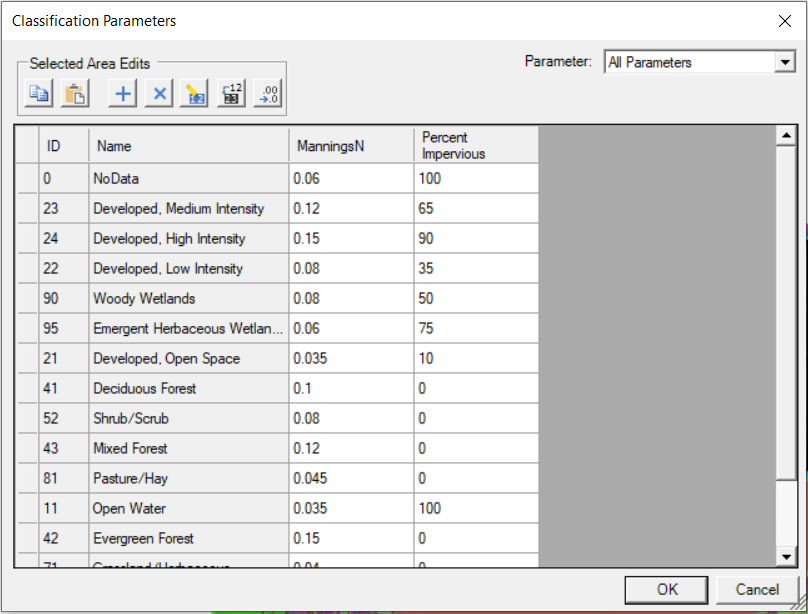
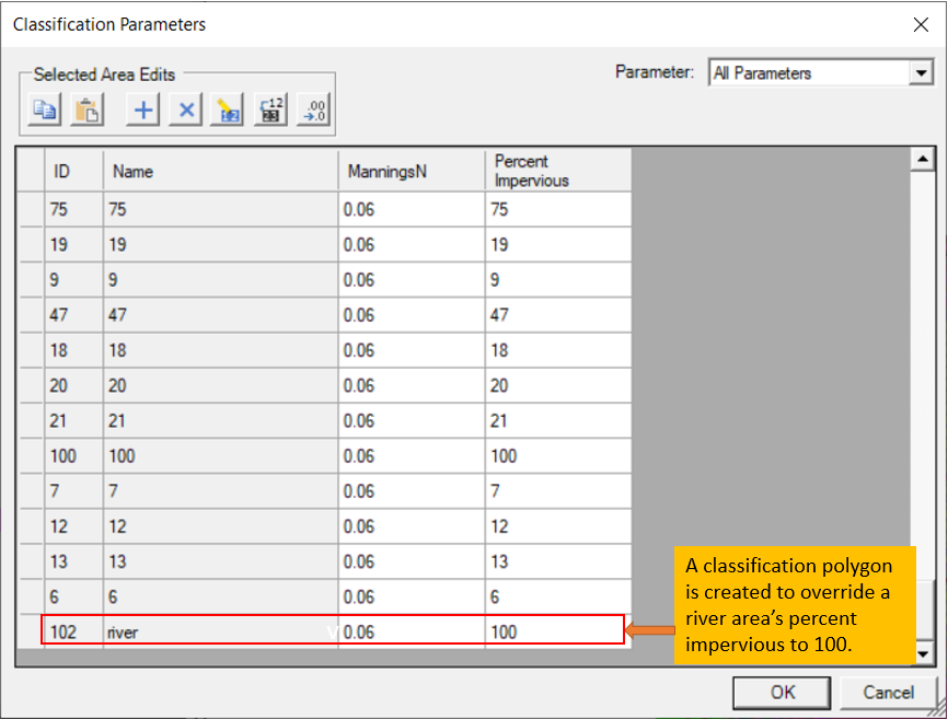
Enter the percent impervious values in the newly created land cover layer (Figure 4). The percent impervious values are the same values as the NLCD impervious raster pixel values which are under the column of “Name” of Figure 4. In NLCD impervious raster files, rivers/waterbodies may be defined as areas with 0 percent impervious together with other completely pervious areas like crop fields, but in H&H modeling they are usually treated as 100% impervious. To re-set the waterbody regions to 100% impervious, apply classification polygons to override it (Figure 5).

The newly created land cover layer for percent impervious needs to be associated with the geometry as its % Impervious file (Figure 6).

Leave a Reply