Rational Routing in InfoWorks ICM
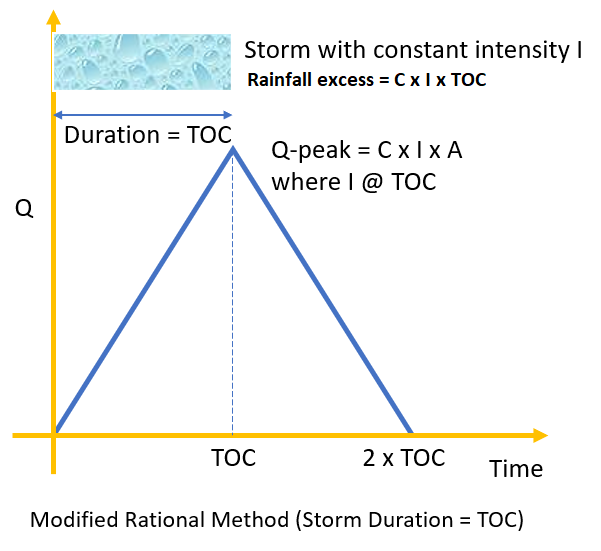
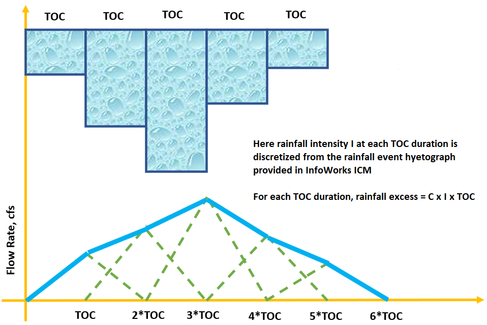
In addition to various unit hydrograph transform methods and SWMM nonlinear reservoir runoff method, InfoWorks ICM also has a built-in rational routing model for rainfall-runoff process. To utilize the Modified Rational Method hydrograph concept (Figure 1), the InfoWorks rational routing model first converts a continuous rainfall hyetograph into discrete ones with the same rainfall duration of TOC. For each discretized rainfall duration of TOC, the sub-hydrograph will be generated according to the procedures of Modified Rational Method and the final total hydrograph is the sum of all the sub-hydrographs (Figure 2).
The rational routing model only needs two parameters of a subcatchment – time of concentration (TOC) and runoff coefficient (C), which are relatively easy to estimate given a subcatchment. The rational routing model implementation in InfoWorks ICM is explained below.
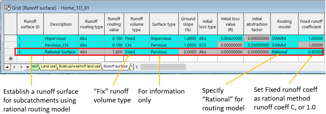
First, define a rational routing runoff surface as shown in Figure 3. For this surface, set the routing model as “Rational” and the runoff volume type as “Fixed”. Enter the Fixed runoff coefficient as the rational method runoff coefficient C (Figure 3) or 1.0 (Figure 7).
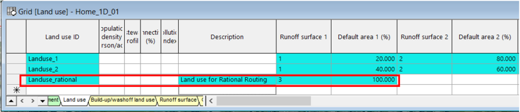
Second, create a land use using the runoff surface created above and set its area percentage as 100% (Figure 4).
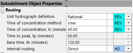
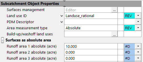
Third, in subcatchment property editor, choose “Rational” as routing method and enter time of concentration in minutes (Figure 5). Make sure the land use is selected as the one created above (Figure 6).
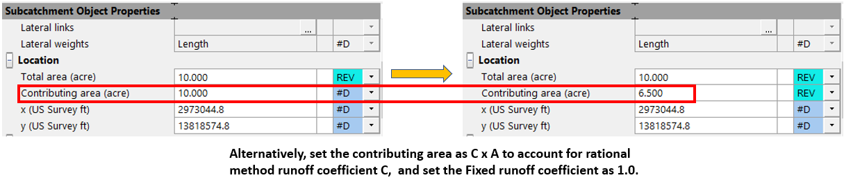
The rational method coefficient is entered as “Fixed runoff coefficient” in Figure 3. Alternatively, calculate the subcatchment contributing area as C x A to account for rational method runoff coefficient C (Figure 7), and at the same time set the Fixed runoff coefficient as 1.0 for the rational routing runoff surface. This is useful if different subcatchments have different runoff coefficient C and you don’t want to create a runoff surface for each subcatchment individually.
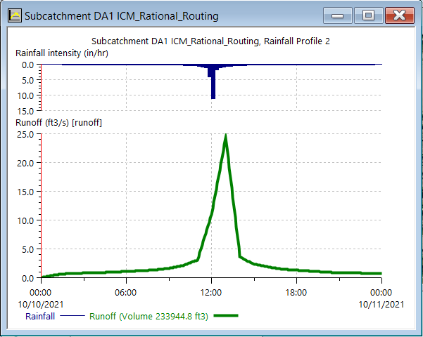
An example project was set up using Rational Routing Model with TOC of 60 min and its runoff hydrograph is shown in Figure 8 under a 24hr SCS storm event.
Like the traditional rational method, the rational routing model is applicable for a small subcatchment area not larger than 200 acres (some regulating agencies allow this upper limit up to 640 acres).
1 COMMENT